Graphic window
The graphic window in NetSim is a CAD component which shows the pipe network in the selected model with the correct coordinates. The coordinate system is an arbitrary orthogonal system where the y-axis is of north and x-axis is of east.
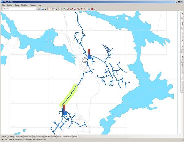
You can use map files, schedules, etc. in DWG/DXF format as backgrounds to the pipe network. These backgrounds may also include graphics as orthophotos.
You can create pipes in and delete them in the graphic window. Points and opens the forms in the database.
You can save the network image from the graphic window in DWG/DXF + a number of raster formats and print out all or parts of the network to an optional scale.
You can use the layer properties manager under Settings in the menu to select colours and line widths in the map screen for the best display of the pipe network.